
blah blah blah
Plymouth Mountain
Length: 4.9 miles out-and-backDifficulty (click for info): Moderate
Elevation Gain: 1420 feet (+120 feet on return)
Rating (click for info): 6/10
Elevation: 2193'
Prominence: 1323'
Driving Directions:
Trailhead and parking area are on Old Hebron Road in Plymouth, NH. From Rt. 3, 3.0 miles north of Exit 24 off Rt. 93 and 2.2 miles south of the junction with Rt. 175A in the center of Plymouth at the rotary, turn west onto Cummings Hill Road. Drive 1.3 miles and take a right onto Texas Hill Road. Continue another 1.3 miles and bear left onto Old Hebron Road. The parking area appears on the left in 0.1 miles. Click here for a Google map.
About the Hike:
The highest point in the college town of Plymouth is the succinctly-named Plymouth Mountain. Located not far from the interstate, the mountain rises between Newfound Lake, the Tenney Mountain wind farm and ski area, and downtown Plymouth. While not a particularly tall peak in comparison to those a few miles to the north in the southern reaches of the Whites, Plymouth is a broad and very prominent mass of a mountain. It is noticeable from many places, although few people have heard its name. The few trails accessing it are mostly locally known and don't receive a high volume of traffic, making it a nice option for busier days. While low in height, it is still a moderate climb with respectable elevation gain. Various lookouts around the top of the mountain give it fine views of the nearby White Mountains and the surrounding terrain.
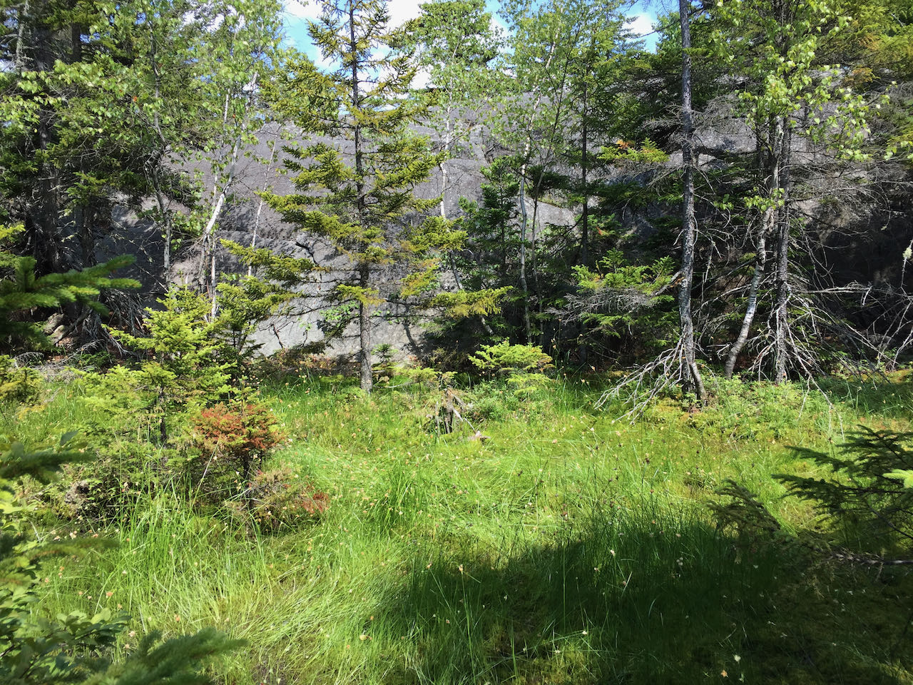
From the parking area, head off into the woods on Fauver Link Trail, passing an informational kiosk. The trail crosses two small brooks, the first with a wooden bridge, and then begins to ascend moderately. In 0.4 miles, a grassy road is crossed, and the trail becomes Sutherland Trail (look for a trail sign). The trail passes a sign marking a conservation easement and makes a bit of a switchback uphill over roots and rocks. After about 0.15 miles uphill, the trail levels off on a plateau and passes a large vernal pool. It remains flat for 0.15 miles, then climbs uphill for 0.1 miles, wrapping around a rocky knoll in the forest. At an unmarked junction, a path leads through twisted hemlocks to the top of the ledge, which overlooks only the trees surrounding. This is half a mile from the beginning of the Sutherland Trail at the old road. The main trail sets off across another brief flat stretch, then resumes its steady climb. Weaving uphill through a bright, fern-filled forest with the occasional rock slab underfoot, the trail continues half a mile and crosses a little, pebble-strewn stream. Climbing 0.4 miles further, arrive at a T-junction, where a decorative trail sign points the way to Pike's Peak.
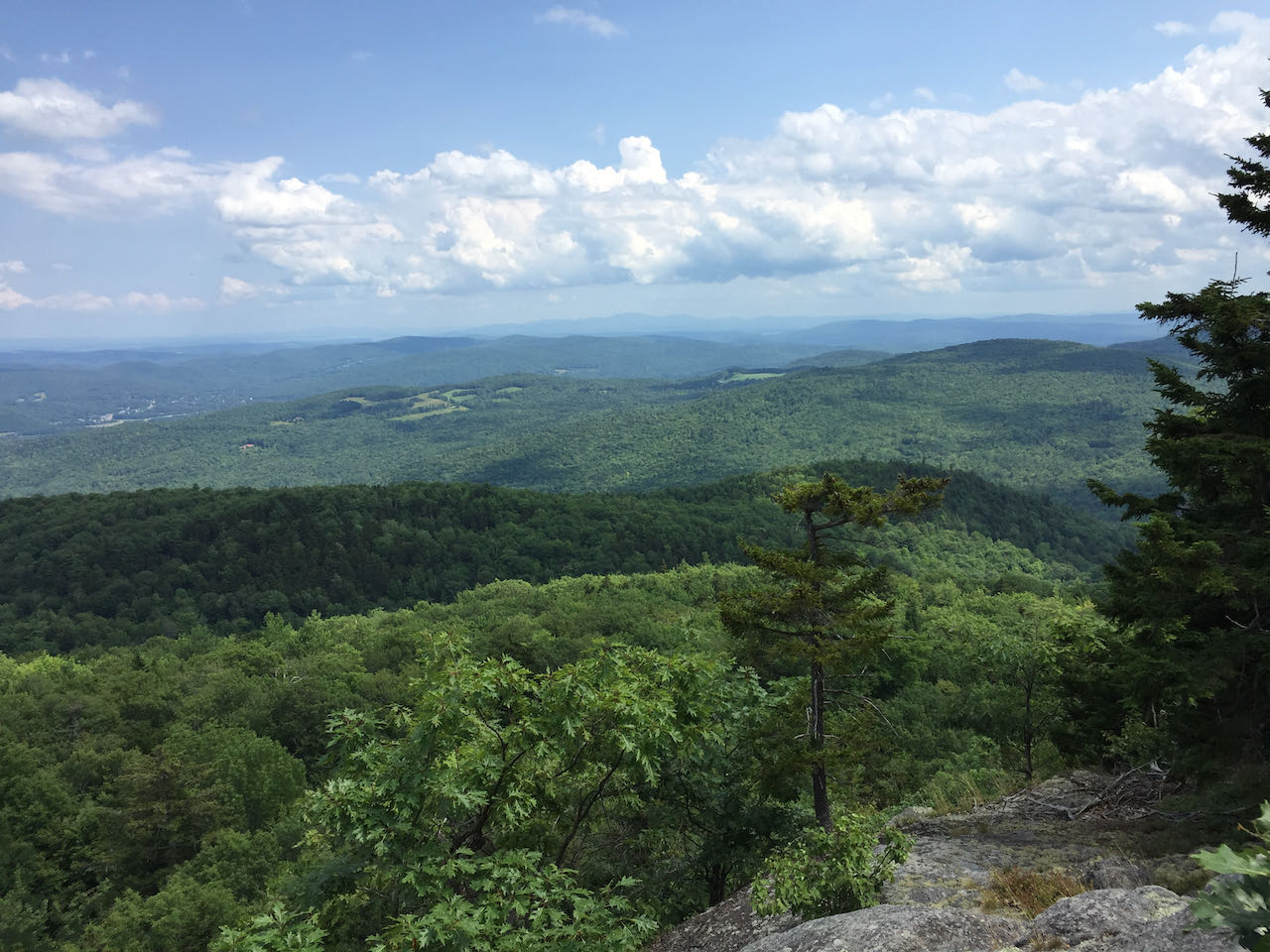
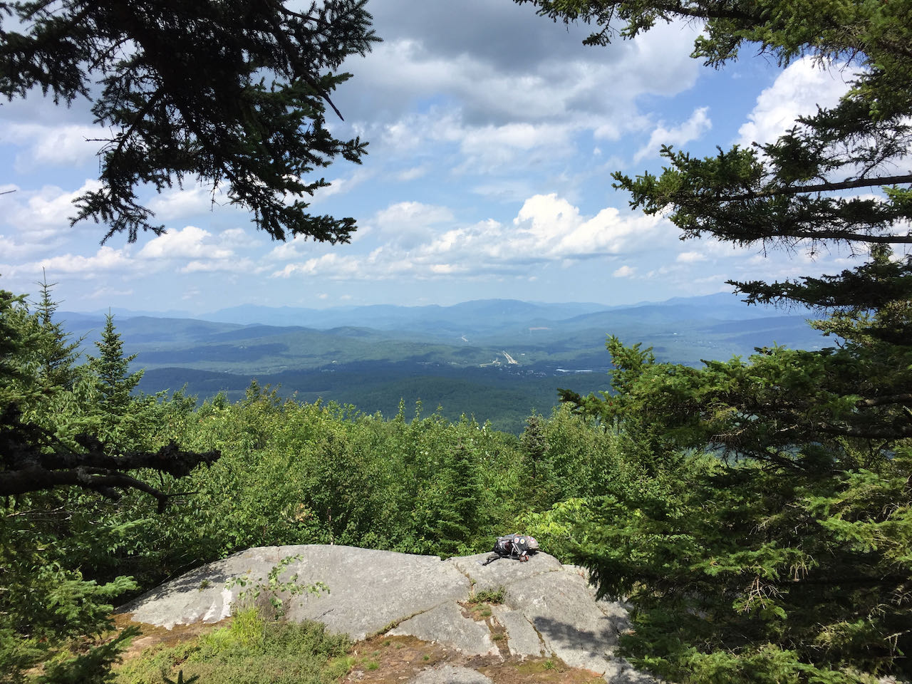
Turn left on the short spur path and wander out onto the open rock knob, where a fine vista to the north is presented for you. Over the treetops to the left, observe the broad mass of Carr Mountain, with Stinson Mountain to its right, and its long trailing ridge which leads down to the low hills surrounding downtown Plymouth. Mt. Moosilauke appears behind and to the right of Stinson. The main features in the distance are the Kinsman Range and the Franconia Range, on the left and right of Franconia Notch. Further over, behind the extending line of I-93, many more summits in the central Whites can be observed, including the familiar ledgy bumps of Welch and Dickey in front of Mt. Tecumseh. The Sandwich Range trails off to the right, with distinctive, twin-topped Sandwich Dome starting the chain and Mt. Whiteface noticeable to the right. Closer and to the right are the lower, rolling hills of the Squam Range, with Mt. Prospect first and the long ridge of Mt. Webster also visible. Furthest over, through a gap in the trees, you can look over to the Ossipees. When you've enjoyed a suitable scenery break and are ready to proceed to summit Plymouth Mountain, return to the junction. Alternatively, make this your destination for the day and head back the way you came (trimming your trek down to a milder 3.6 miles total).
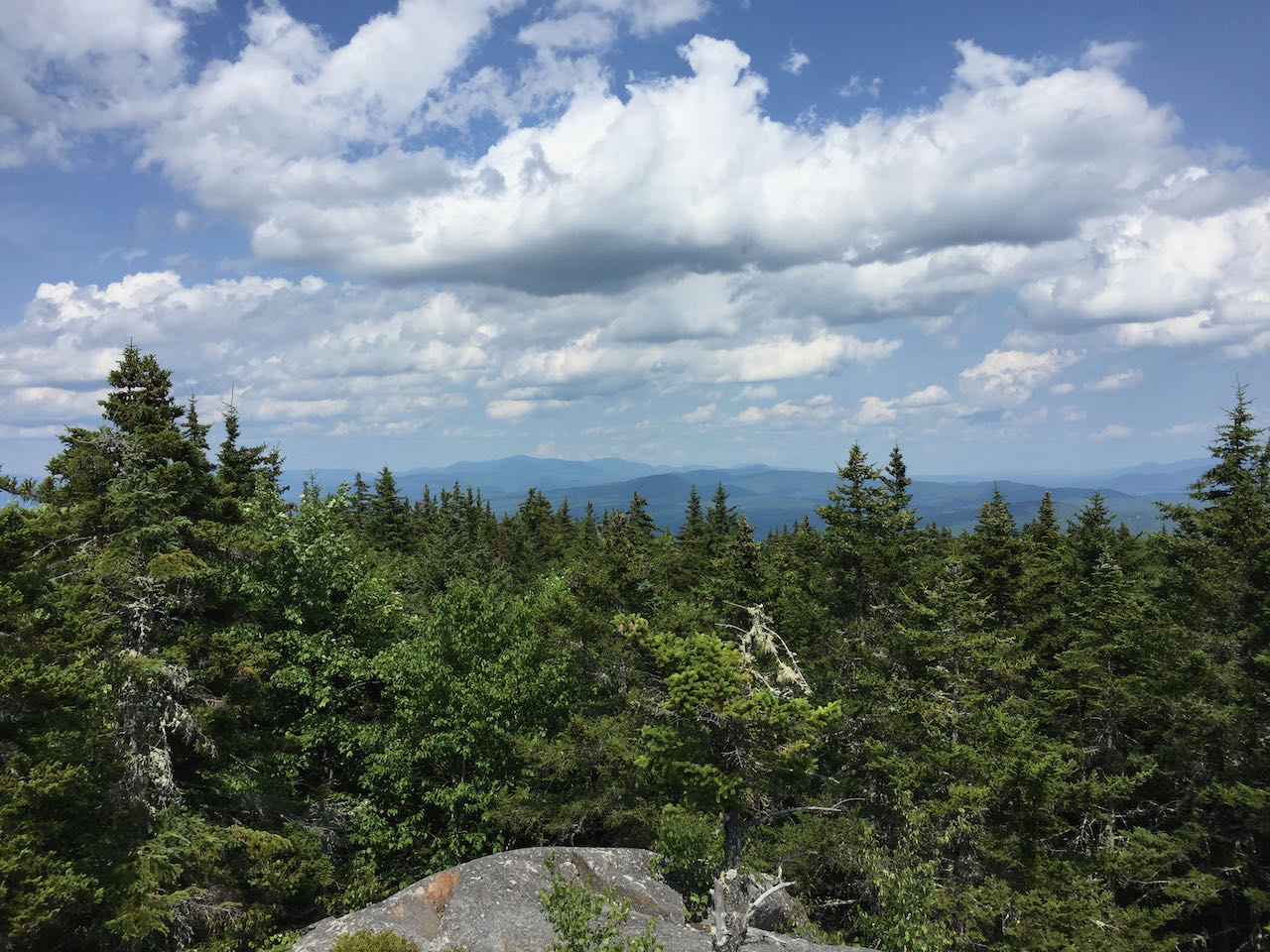
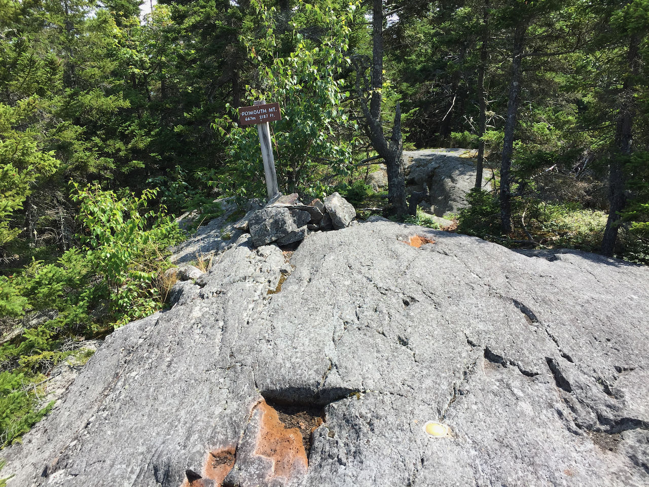
Continuing on the Sutherland Trail, now across flatter terrain, you will soon reach the semi-forested ledges covering the top. This is a particularly scenic area to enjoy. The trail wanders across the rock, passes a small, grassy bog, and scrambles up a short blockade of nearly vertical rock. Right after this, at 0.15 miles from the junction, an unmarked path diverges across the sloping lege to the left. This offers a short side trip (included in trip figures) to the mountain's east cliff. Use caution when deciding whether to venture out this way, as the path is seldom used and can be difficult to follow. It is occasionally marked with cairns, and leads 0.2 miles through moss-draped conifer forest out to the wide-open vista looking eastward. From here, you can see some of what you took in from the Pike's Peak lookout, now with an unobstructed view to the Ossipees. Quite a bit of the Lakes Region is now in view, including the Belknap Range off to the southeast. A few isolated hills to the south present themselves, and furthest over to the right you can see the stepped ridge of Hersey Mountain. After your stay here, make your way back to the main trail and continue through mixed forest and rock. In just a bit, the trail encounters two uplifted rocks, with views just over the treetops, passing over the first, and skirting around the second. In not more than 0.1 miles from the side path, the trail climbs a ledge ramp up to the rocky, true summit of Plymouth Mountain, without views and marked with a benchmark and a signpost. A final viewpoint is accessible by following a narrow beaten path behind the sign. Look for small cairns as it drops a couple hundred yards to a forested ledge, continues down into the woods again, and emerges on a more open ledge with great southwesterly view across the Lakes Region, Newfound Lake, and toward Mt. Cardigan.
Printable directions page